 https://vexceldata.com/wp-content/uploads/2025/09/Charleston-SC-32.756116-79.986702.jpg
720
1280
Angie Brewster
https://vexceldata.com/wp-content/uploads/2021/12/VEXCEL-Data-Program.png
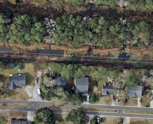
Angie Brewster2025-09-11 08:30:452025-09-11 08:30:45Mapping the Path Forward
https://vexceldata.com/wp-content/uploads/2025/09/Charleston-SC-32.756116-79.986702.jpg
720
1280
Angie Brewster
https://vexceldata.com/wp-content/uploads/2021/12/VEXCEL-Data-Program.png
Angie Brewster2025-09-11 08:30:452025-09-11 08:30:45Mapping the Path Forward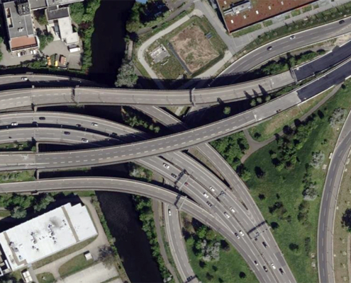 https://vexceldata.com/wp-content/uploads/2025/09/Berlin-Germany-52.463780-13.453301.jpg
576
1024
Angie Brewster
https://vexceldata.com/wp-content/uploads/2021/12/VEXCEL-Data-Program.png
Angie Brewster2025-09-05 14:09:032025-09-05 15:30:03Seeing the Road Ahead: How Vexcel Supports Smarter Transportation Planning
https://vexceldata.com/wp-content/uploads/2025/09/Berlin-Germany-52.463780-13.453301.jpg
576
1024
Angie Brewster
https://vexceldata.com/wp-content/uploads/2021/12/VEXCEL-Data-Program.png
Angie Brewster2025-09-05 14:09:032025-09-05 15:30:03Seeing the Road Ahead: How Vexcel Supports Smarter Transportation Planning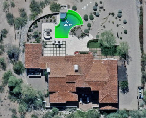 https://vexceldata.com/wp-content/uploads/2025/07/4743-N-54th-St-Phoenix-AZ-85018-USA_polygon.jpg
720
1280
Angie Brewster
https://vexceldata.com/wp-content/uploads/2021/12/VEXCEL-Data-Program.png
Angie Brewster2025-07-16 08:00:442025-07-16 08:01:18How Many Pools are in Phoenix? Elements AI Gave Us the Answer
https://vexceldata.com/wp-content/uploads/2025/07/4743-N-54th-St-Phoenix-AZ-85018-USA_polygon.jpg
720
1280
Angie Brewster
https://vexceldata.com/wp-content/uploads/2021/12/VEXCEL-Data-Program.png
Angie Brewster2025-07-16 08:00:442025-07-16 08:01:18How Many Pools are in Phoenix? Elements AI Gave Us the Answer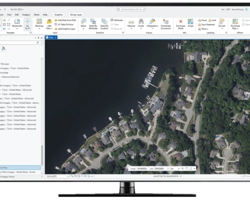 https://vexceldata.com/wp-content/uploads/2025/07/ArcGIS-Computer-Screen.png
777
1280
Angie Brewster
https://vexceldata.com/wp-content/uploads/2021/12/VEXCEL-Data-Program.png
Angie Brewster2025-07-09 08:06:462025-07-09 08:06:46Need Fast Access to Imagery and Data in ArcGIS? Vexcel Has You Covered
https://vexceldata.com/wp-content/uploads/2025/07/ArcGIS-Computer-Screen.png
777
1280
Angie Brewster
https://vexceldata.com/wp-content/uploads/2021/12/VEXCEL-Data-Program.png
Angie Brewster2025-07-09 08:06:462025-07-09 08:06:46Need Fast Access to Imagery and Data in ArcGIS? Vexcel Has You Covered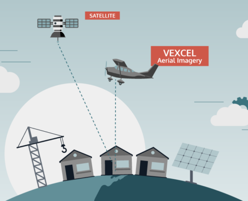 https://vexceldata.com/wp-content/uploads/2025/07/VEX-623-GRA-Satellite-vs-Aerial-Graphic_Light-BG_Satellite-Aerial.png
576
1024
Angie Brewster
https://vexceldata.com/wp-content/uploads/2021/12/VEXCEL-Data-Program.png
Angie Brewster2025-07-03 08:38:432025-07-09 15:30:51Aerial vs. Satellite Imagery: What’s the Difference, and Why It Matters
https://vexceldata.com/wp-content/uploads/2025/07/VEX-623-GRA-Satellite-vs-Aerial-Graphic_Light-BG_Satellite-Aerial.png
576
1024
Angie Brewster
https://vexceldata.com/wp-content/uploads/2021/12/VEXCEL-Data-Program.png
Angie Brewster2025-07-03 08:38:432025-07-09 15:30:51Aerial vs. Satellite Imagery: What’s the Difference, and Why It Matters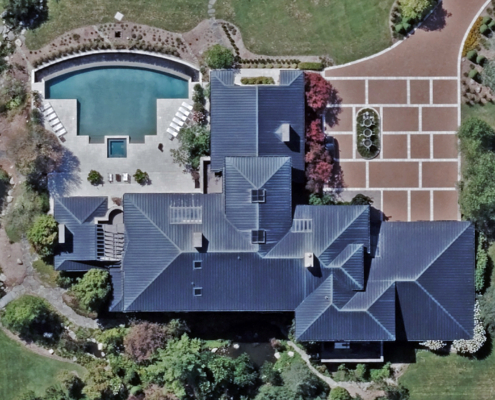 https://vexceldata.com/wp-content/uploads/2025/06/4000-Vorhies-Rd-Ann-Arbor-MI-48105-USA_.jpg
1152
2048
Angie Brewster
https://vexceldata.com/wp-content/uploads/2021/12/VEXCEL-Data-Program.png
Angie Brewster2025-06-12 09:58:452025-06-12 09:58:45What Can 100 Random Properties Tell You About Risk? A Lot.
https://vexceldata.com/wp-content/uploads/2025/06/4000-Vorhies-Rd-Ann-Arbor-MI-48105-USA_.jpg
1152
2048
Angie Brewster
https://vexceldata.com/wp-content/uploads/2021/12/VEXCEL-Data-Program.png
Angie Brewster2025-06-12 09:58:452025-06-12 09:58:45What Can 100 Random Properties Tell You About Risk? A Lot.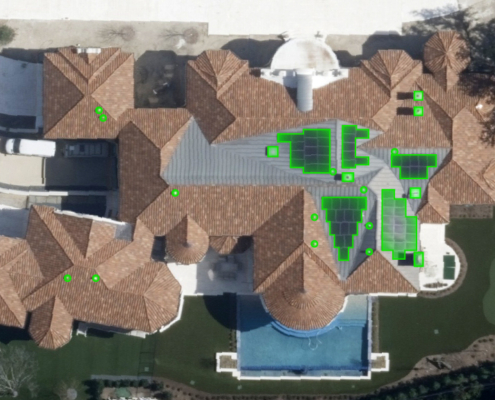 https://vexceldata.com/wp-content/uploads/2025/06/VEX-616-GRA-Elements-Roofing-Items-for-Blog-03.jpg
576
1024
Angie Brewster
https://vexceldata.com/wp-content/uploads/2021/12/VEXCEL-Data-Program.png
Angie Brewster2025-06-03 09:10:402025-08-25 16:22:50Rooftop Intel: Where AI Meets the Shingles
https://vexceldata.com/wp-content/uploads/2025/06/VEX-616-GRA-Elements-Roofing-Items-for-Blog-03.jpg
576
1024
Angie Brewster
https://vexceldata.com/wp-content/uploads/2021/12/VEXCEL-Data-Program.png
Angie Brewster2025-06-03 09:10:402025-08-25 16:22:50Rooftop Intel: Where AI Meets the Shingles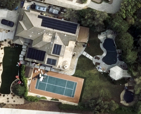 https://vexceldata.com/wp-content/uploads/2025/05/34.210502-118.907564ThousandOaks-CA.jpg
576
1024
Angie Brewster
https://vexceldata.com/wp-content/uploads/2021/12/VEXCEL-Data-Program.png
Angie Brewster2025-05-28 08:23:132025-05-28 14:50:25Trampolines: Provo, UT vs. Conroe, TX
https://vexceldata.com/wp-content/uploads/2025/05/34.210502-118.907564ThousandOaks-CA.jpg
576
1024
Angie Brewster
https://vexceldata.com/wp-content/uploads/2021/12/VEXCEL-Data-Program.png
Angie Brewster2025-05-28 08:23:132025-05-28 14:50:25Trampolines: Provo, UT vs. Conroe, TX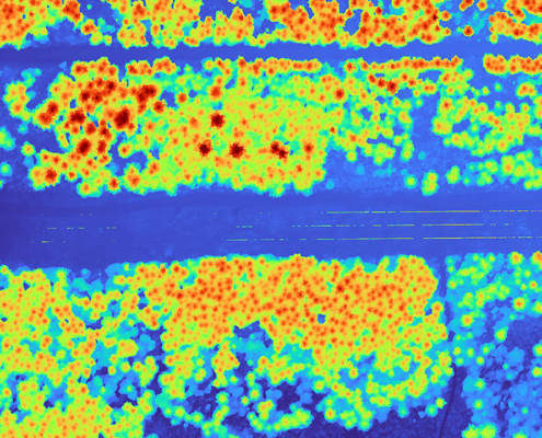 https://vexceldata.com/wp-content/uploads/2025/05/Ravensdale-WA-47.364353-121.950564-DSM.jpg
720
1280
Angie Brewster
https://vexceldata.com/wp-content/uploads/2021/12/VEXCEL-Data-Program.png
Angie Brewster2025-05-05 10:45:022025-05-05 10:46:04High-res Imagery & DSM for Utilities Vegetation Management
https://vexceldata.com/wp-content/uploads/2025/05/Ravensdale-WA-47.364353-121.950564-DSM.jpg
720
1280
Angie Brewster
https://vexceldata.com/wp-content/uploads/2021/12/VEXCEL-Data-Program.png
Angie Brewster2025-05-05 10:45:022025-05-05 10:46:04High-res Imagery & DSM for Utilities Vegetation Management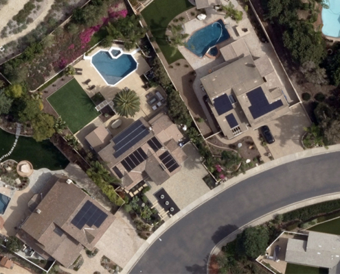 https://vexceldata.com/wp-content/uploads/2025/04/32.904866-117.073170-Scripps-Ranch.jpg
576
1024
Angie Brewster
https://vexceldata.com/wp-content/uploads/2021/12/VEXCEL-Data-Program.png
Angie Brewster2025-04-22 08:38:012025-04-22 08:42:17Spotting Solar Panel Growth from Above
https://vexceldata.com/wp-content/uploads/2025/04/32.904866-117.073170-Scripps-Ranch.jpg
576
1024
Angie Brewster
https://vexceldata.com/wp-content/uploads/2021/12/VEXCEL-Data-Program.png
Angie Brewster2025-04-22 08:38:012025-04-22 08:42:17Spotting Solar Panel Growth from Above
