
Tag Archive for: aerial imagery
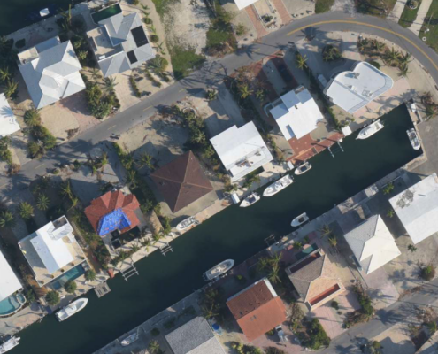 https://vexceldata.com/wp-content/uploads/2021/05/BuenaVistaCT_Islamorada_FL_Sep2017.png
821
1306
Angie Brewster
https://vexceldata.com/wp-content/uploads/2021/12/VEXCEL-Data-Program.png
Angie Brewster2021-05-18 11:01:402024-10-08 08:37:44Uncovering a $2.5M Property Claims Fraud Scheme with High-Res Imagery
https://vexceldata.com/wp-content/uploads/2021/05/BuenaVistaCT_Islamorada_FL_Sep2017.png
821
1306
Angie Brewster
https://vexceldata.com/wp-content/uploads/2021/12/VEXCEL-Data-Program.png
Angie Brewster2021-05-18 11:01:402024-10-08 08:37:44Uncovering a $2.5M Property Claims Fraud Scheme with High-Res Imagery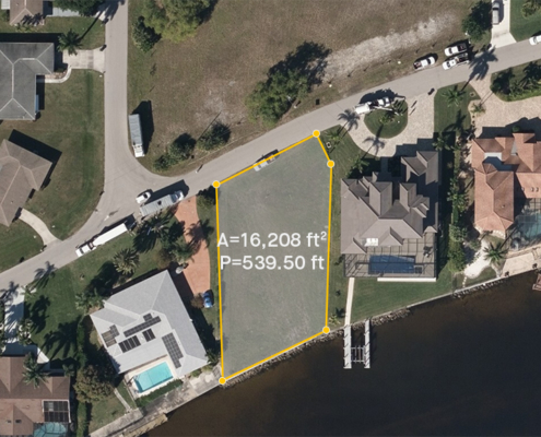 https://vexceldata.com/wp-content/uploads/2021/02/cape_coral_florida_ortho_aerameasurement.jpg
576
1024
Angie Brewster
https://vexceldata.com/wp-content/uploads/2021/12/VEXCEL-Data-Program.png
Angie Brewster2021-05-06 20:56:582021-05-06 20:56:58Fast-track Property Valuations with High-Res Aerial Imagery
https://vexceldata.com/wp-content/uploads/2021/02/cape_coral_florida_ortho_aerameasurement.jpg
576
1024
Angie Brewster
https://vexceldata.com/wp-content/uploads/2021/12/VEXCEL-Data-Program.png
Angie Brewster2021-05-06 20:56:582021-05-06 20:56:58Fast-track Property Valuations with High-Res Aerial Imagery https://vexceldata.com/wp-content/uploads/2021/04/CIR-Monitor-with-screens.jpg
1152
2048
Angie Brewster
https://vexceldata.com/wp-content/uploads/2021/12/VEXCEL-Data-Program.png
Angie Brewster2021-04-30 13:53:182024-10-08 08:37:44Your View Just Got an Upgrade – New Updates to VIEWER
https://vexceldata.com/wp-content/uploads/2021/04/CIR-Monitor-with-screens.jpg
1152
2048
Angie Brewster
https://vexceldata.com/wp-content/uploads/2021/12/VEXCEL-Data-Program.png
Angie Brewster2021-04-30 13:53:182024-10-08 08:37:44Your View Just Got an Upgrade – New Updates to VIEWER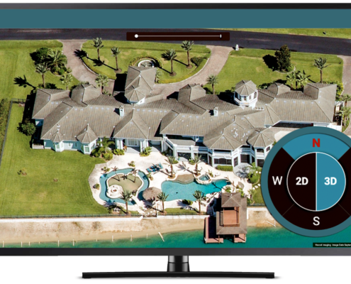 https://vexceldata.com/wp-content/uploads/2021/04/Screen-Shot-2021-04-28-at-3.28.56-PM.png
808
1326
Angie Brewster
https://vexceldata.com/wp-content/uploads/2021/12/VEXCEL-Data-Program.png
Angie Brewster2021-04-29 14:59:452021-05-04 18:54:43Your VIEW Just Got an Upgrade – New Updates to VIEWER
https://vexceldata.com/wp-content/uploads/2021/04/Screen-Shot-2021-04-28-at-3.28.56-PM.png
808
1326
Angie Brewster
https://vexceldata.com/wp-content/uploads/2021/12/VEXCEL-Data-Program.png
Angie Brewster2021-04-29 14:59:452021-05-04 18:54:43Your VIEW Just Got an Upgrade – New Updates to VIEWER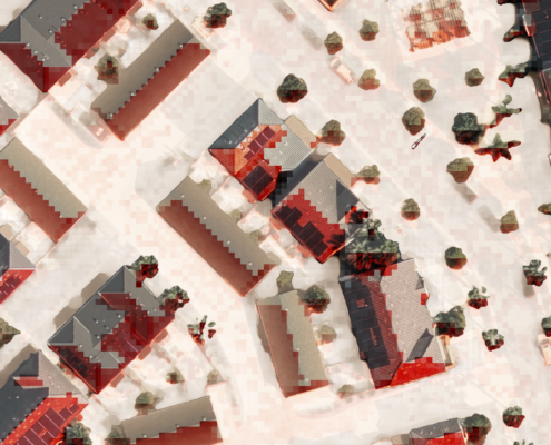 https://vexceldata.com/wp-content/uploads/2021/03/DSM-Solar.png
2839
4959
Steve Lombardi
https://vexceldata.com/wp-content/uploads/2021/12/VEXCEL-Data-Program.png
Steve Lombardi2021-03-10 21:05:012024-06-11 14:00:41NEW: Digital Surface Model API Now Available
https://vexceldata.com/wp-content/uploads/2021/03/DSM-Solar.png
2839
4959
Steve Lombardi
https://vexceldata.com/wp-content/uploads/2021/12/VEXCEL-Data-Program.png
Steve Lombardi2021-03-10 21:05:012024-06-11 14:00:41NEW: Digital Surface Model API Now Available https://vexceldata.com/wp-content/uploads/2021/02/Boston_MA__Aerial_Image_Oblique.jpg
576
1024
Angie Brewster
https://vexceldata.com/wp-content/uploads/2021/12/VEXCEL-Data-Program.png
Angie Brewster2021-03-08 23:12:302021-03-08 23:12:30Introducing VEXCELDATA.COM: the technology, the products, the use cases
https://vexceldata.com/wp-content/uploads/2021/02/Boston_MA__Aerial_Image_Oblique.jpg
576
1024
Angie Brewster
https://vexceldata.com/wp-content/uploads/2021/12/VEXCEL-Data-Program.png
Angie Brewster2021-03-08 23:12:302021-03-08 23:12:30Introducing VEXCELDATA.COM: the technology, the products, the use cases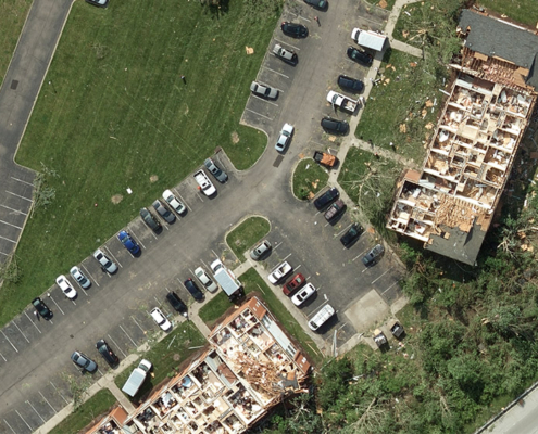 Geospatial Insurance Consortium
https://vexceldata.com/wp-content/uploads/2020/12/Dayton_OH_Aerial_Image_Tornado-1.jpg
563
1000
kris.wagner
https://vexceldata.com/wp-content/uploads/2021/12/VEXCEL-Data-Program.png
kris.wagner2020-12-16 23:43:412024-10-08 08:37:46Tornados, Hurricanes, Wildfires, Oh My—A Year to Remember with Gray SkyGeospatial Insurance Consortium
https://vexceldata.com/wp-content/uploads/2021/12/VEXCEL-Data-Program.png
0
0
kris.wagner
https://vexceldata.com/wp-content/uploads/2021/12/VEXCEL-Data-Program.png
kris.wagner2018-10-15 22:32:502024-10-08 08:38:34Geospatial Intelligence Center Mounts Large Scale Aerial Imaging Response to Hurricane MichaelGeospatial Insurance Consortium
https://vexceldata.com/wp-content/uploads/2021/12/VEXCEL-Data-Program.png
0
0
kris.wagner
https://vexceldata.com/wp-content/uploads/2021/12/VEXCEL-Data-Program.png
kris.wagner2018-10-04 19:36:432024-10-08 08:39:05Geospatial Intelligence Center Provides Before and After Views of Damaged Properties from Hurricane Florence
Geospatial Insurance Consortium
https://vexceldata.com/wp-content/uploads/2020/12/Dayton_OH_Aerial_Image_Tornado-1.jpg
563
1000
kris.wagner
https://vexceldata.com/wp-content/uploads/2021/12/VEXCEL-Data-Program.png
kris.wagner2020-12-16 23:43:412024-10-08 08:37:46Tornados, Hurricanes, Wildfires, Oh My—A Year to Remember with Gray SkyGeospatial Insurance Consortium
https://vexceldata.com/wp-content/uploads/2021/12/VEXCEL-Data-Program.png
0
0
kris.wagner
https://vexceldata.com/wp-content/uploads/2021/12/VEXCEL-Data-Program.png
kris.wagner2018-10-15 22:32:502024-10-08 08:38:34Geospatial Intelligence Center Mounts Large Scale Aerial Imaging Response to Hurricane MichaelGeospatial Insurance Consortium
https://vexceldata.com/wp-content/uploads/2021/12/VEXCEL-Data-Program.png
0
0
kris.wagner
https://vexceldata.com/wp-content/uploads/2021/12/VEXCEL-Data-Program.png
kris.wagner2018-10-04 19:36:432024-10-08 08:39:05Geospatial Intelligence Center Provides Before and After Views of Damaged Properties from Hurricane Florence