
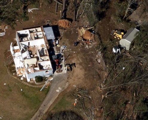
 GIC
https://vexceldata.com/wp-content/uploads/2021/01/Fultondale_Tornado_Aerial_Image_Jan_2021_5.jpg
563
1000
vexcel
https://vexceldata.com/wp-content/uploads/2021/12/VEXCEL-Data-Program.png
vexcel2021-01-31 11:50:502024-10-08 08:37:46Alabama Tornado Response: Capturing the First Major Disaster of 2021
GIC
https://vexceldata.com/wp-content/uploads/2021/01/Fultondale_Tornado_Aerial_Image_Jan_2021_5.jpg
563
1000
vexcel
https://vexceldata.com/wp-content/uploads/2021/12/VEXCEL-Data-Program.png
vexcel2021-01-31 11:50:502024-10-08 08:37:46Alabama Tornado Response: Capturing the First Major Disaster of 2021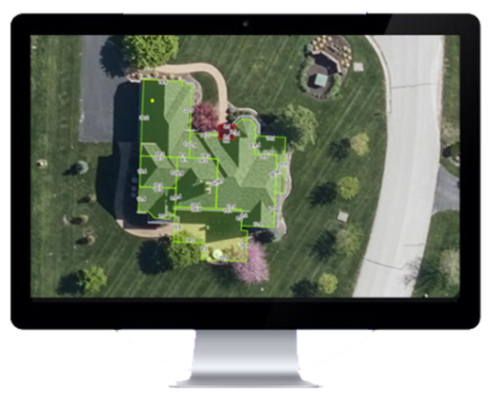 https://vexceldata.com/wp-content/uploads/2021/01/Screen-Shot-2021-04-29-at-9.10.46-AM.png
422
532
vexcel
https://vexceldata.com/wp-content/uploads/2021/12/VEXCEL-Data-Program.png
vexcel2021-01-27 05:25:502026-02-21 21:49:53Geospan Corporation and Vexcel Imaging Announce Partnership to Bring National 4D Geospatial Solutions to Local Government, Insurance, and Mortgage Industries
https://vexceldata.com/wp-content/uploads/2021/01/Screen-Shot-2021-04-29-at-9.10.46-AM.png
422
532
vexcel
https://vexceldata.com/wp-content/uploads/2021/12/VEXCEL-Data-Program.png
vexcel2021-01-27 05:25:502026-02-21 21:49:53Geospan Corporation and Vexcel Imaging Announce Partnership to Bring National 4D Geospatial Solutions to Local Government, Insurance, and Mortgage Industries