 https://vexceldata.com/wp-content/uploads/2026/02/Screenshot-2026-02-24-at-8.40.45-AM.png
774
975
vexcel
https://vexceldata.com/wp-content/uploads/2021/12/VEXCEL-Data-Program.png
vexcel2026-02-24 11:40:212026-02-24 11:42:31Introducing Vexcel Intelligence: AI for the Real World
https://vexceldata.com/wp-content/uploads/2026/02/Screenshot-2026-02-24-at-8.40.45-AM.png
774
975
vexcel
https://vexceldata.com/wp-content/uploads/2021/12/VEXCEL-Data-Program.png
vexcel2026-02-24 11:40:212026-02-24 11:42:31Introducing Vexcel Intelligence: AI for the Real World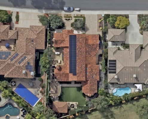 https://vexceldata.com/wp-content/uploads/2026/02/San-Diego-CA-32.906566-117.064902.jpg
720
1280
vexcel
https://vexceldata.com/wp-content/uploads/2021/12/VEXCEL-Data-Program.png
vexcel2026-02-17 07:05:102026-02-19 13:20:23Announcing the 2026 U.S. Collection Plan
https://vexceldata.com/wp-content/uploads/2026/02/San-Diego-CA-32.906566-117.064902.jpg
720
1280
vexcel
https://vexceldata.com/wp-content/uploads/2021/12/VEXCEL-Data-Program.png
vexcel2026-02-17 07:05:102026-02-19 13:20:23Announcing the 2026 U.S. Collection Plan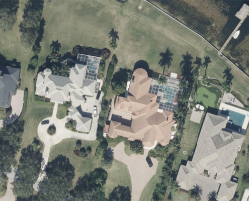 https://vexceldata.com/wp-content/uploads/2025/02/27.969982-81.688204-WinterHaven-FL.jpg
576
1024
vexcel
https://vexceldata.com/wp-content/uploads/2021/12/VEXCEL-Data-Program.png
vexcel2025-02-14 10:53:532025-02-14 10:53:53KBA Group Partners with Vexcel to Enhance Geospatial Imagery & Property Data Capabilities
https://vexceldata.com/wp-content/uploads/2025/02/27.969982-81.688204-WinterHaven-FL.jpg
576
1024
vexcel
https://vexceldata.com/wp-content/uploads/2021/12/VEXCEL-Data-Program.png
vexcel2025-02-14 10:53:532025-02-14 10:53:53KBA Group Partners with Vexcel to Enhance Geospatial Imagery & Property Data Capabilities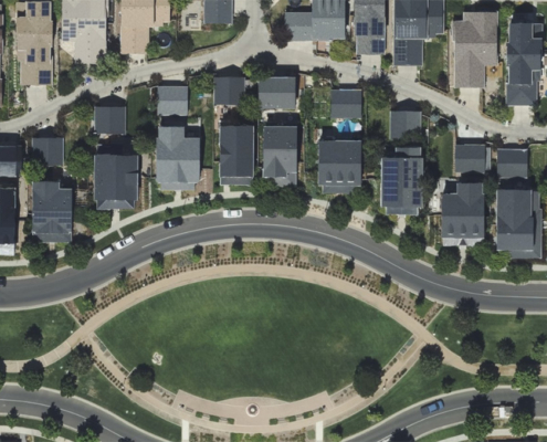 https://vexceldata.com/wp-content/uploads/2025/02/39.765561-104.885564-Aurora-CO-copy.jpg
679
1600
vexcel
https://vexceldata.com/wp-content/uploads/2021/12/VEXCEL-Data-Program.png
vexcel2025-02-10 10:30:502025-02-14 10:44:24Vexcel Announces 2025 Aerial Imagery Collection Program for the U.S.
https://vexceldata.com/wp-content/uploads/2025/02/39.765561-104.885564-Aurora-CO-copy.jpg
679
1600
vexcel
https://vexceldata.com/wp-content/uploads/2021/12/VEXCEL-Data-Program.png
vexcel2025-02-10 10:30:502025-02-14 10:44:24Vexcel Announces 2025 Aerial Imagery Collection Program for the U.S.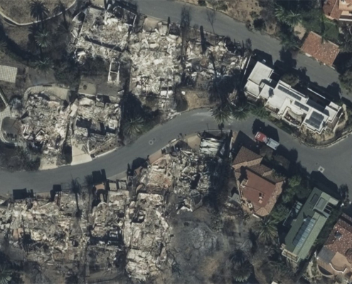 https://vexceldata.com/wp-content/uploads/2025/01/34.039980-118.641958-Malibu-after.jpg
576
1026
vexcel
https://vexceldata.com/wp-content/uploads/2021/12/VEXCEL-Data-Program.png
vexcel2025-01-24 11:44:302025-01-24 12:30:20CoreLogic Provides Enhanced Visualization on the Los Angeles Wildfires Through New Strategic Relationship with Vexcel Imaging
https://vexceldata.com/wp-content/uploads/2025/01/34.039980-118.641958-Malibu-after.jpg
576
1026
vexcel
https://vexceldata.com/wp-content/uploads/2021/12/VEXCEL-Data-Program.png
vexcel2025-01-24 11:44:302025-01-24 12:30:20CoreLogic Provides Enhanced Visualization on the Los Angeles Wildfires Through New Strategic Relationship with Vexcel Imaging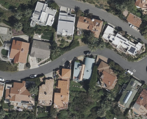 https://vexceldata.com/wp-content/uploads/2025/01/34.039980-118.641958-Malibu-before.jpg
576
1026
vexcel
https://vexceldata.com/wp-content/uploads/2021/12/VEXCEL-Data-Program.png
vexcel2025-01-16 10:10:332025-01-16 10:10:51Vexcel Partners with LIMOSS to Provide Aerial Imagery and Property Insights to the Lloyd’s Market
https://vexceldata.com/wp-content/uploads/2025/01/34.039980-118.641958-Malibu-before.jpg
576
1026
vexcel
https://vexceldata.com/wp-content/uploads/2021/12/VEXCEL-Data-Program.png
vexcel2025-01-16 10:10:332025-01-16 10:10:51Vexcel Partners with LIMOSS to Provide Aerial Imagery and Property Insights to the Lloyd’s Market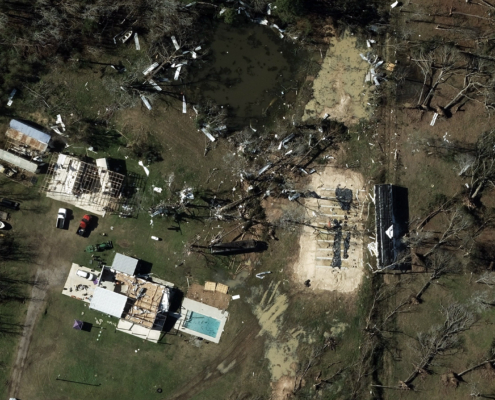 https://vexceldata.com/wp-content/uploads/2024/12/gray-sky-tornado_30.186629_-95.291662.jpg
1152
2048
kris.wagner
https://vexceldata.com/wp-content/uploads/2021/12/VEXCEL-Data-Program.png
kris.wagner2024-12-31 15:27:102024-12-31 17:49:55Gray Sky: Houston Area Tornadoes
https://vexceldata.com/wp-content/uploads/2024/12/gray-sky-tornado_30.186629_-95.291662.jpg
1152
2048
kris.wagner
https://vexceldata.com/wp-content/uploads/2021/12/VEXCEL-Data-Program.png
kris.wagner2024-12-31 15:27:102024-12-31 17:49:55Gray Sky: Houston Area Tornadoes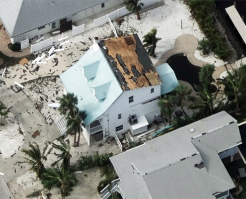 https://vexceldata.com/wp-content/uploads/2024/10/27.523919-82.729011-Oblique-HurricaneMilton.jpg
579
1030
kris.wagner
https://vexceldata.com/wp-content/uploads/2021/12/VEXCEL-Data-Program.png
kris.wagner2024-10-23 10:25:102024-11-07 10:33:33Vexcel Collects High-Resolution Aerial Imagery After Hurricane Milton
https://vexceldata.com/wp-content/uploads/2024/10/27.523919-82.729011-Oblique-HurricaneMilton.jpg
579
1030
kris.wagner
https://vexceldata.com/wp-content/uploads/2021/12/VEXCEL-Data-Program.png
kris.wagner2024-10-23 10:25:102024-11-07 10:33:33Vexcel Collects High-Resolution Aerial Imagery After Hurricane Milton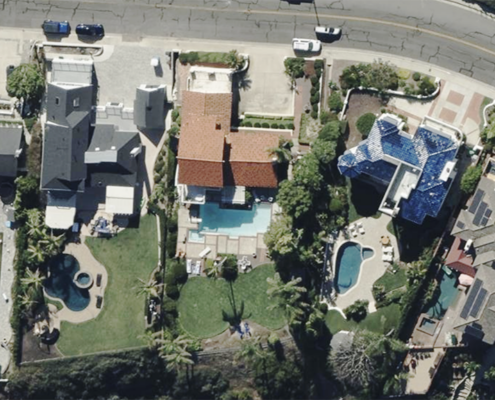 https://vexceldata.com/wp-content/uploads/2024/03/Ortho-SanClemente-CA-33.429051-117.600331.png
576
1024
vexcel
https://vexceldata.com/wp-content/uploads/2021/12/VEXCEL-Data-Program.png
vexcel2024-10-09 16:00:582024-10-09 16:00:58Insurance Trailblazer Orion180 Enhances Underwriting and Claims Operations with Vexcel’s Aerial Imagery and Property Analytics
https://vexceldata.com/wp-content/uploads/2024/03/Ortho-SanClemente-CA-33.429051-117.600331.png
576
1024
vexcel
https://vexceldata.com/wp-content/uploads/2021/12/VEXCEL-Data-Program.png
vexcel2024-10-09 16:00:582024-10-09 16:00:58Insurance Trailblazer Orion180 Enhances Underwriting and Claims Operations with Vexcel’s Aerial Imagery and Property Analytics https://vexceldata.com/wp-content/uploads/2024/09/Palm_Beach_FL_USA_east_oblique_26.790468_-80.jpg
720
1280
vexcel
https://vexceldata.com/wp-content/uploads/2021/12/VEXCEL-Data-Program.png
vexcel2024-09-10 09:06:152024-09-10 13:33:42Windward Risk Managers Enhances Claims Operations with Vexcel’s Aerial Imagery and Damage Assessments
https://vexceldata.com/wp-content/uploads/2024/09/Palm_Beach_FL_USA_east_oblique_26.790468_-80.jpg
720
1280
vexcel
https://vexceldata.com/wp-content/uploads/2021/12/VEXCEL-Data-Program.png
vexcel2024-09-10 09:06:152024-09-10 13:33:42Windward Risk Managers Enhances Claims Operations with Vexcel’s Aerial Imagery and Damage Assessments
