
Tag Archive for: aerial imagery
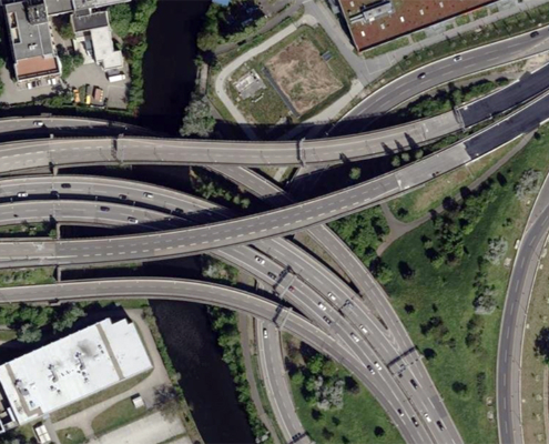 https://vexceldata.com/wp-content/uploads/2025/09/Berlin-Germany-52.463780-13.453301.jpg
576
1024
Angie Brewster
https://vexceldata.com/wp-content/uploads/2021/12/VEXCEL-Data-Program.png
Angie Brewster2025-09-05 14:09:032025-09-23 09:40:10Seeing the Road Ahead: How Vexcel Supports Smarter Transportation Planning
https://vexceldata.com/wp-content/uploads/2025/09/Berlin-Germany-52.463780-13.453301.jpg
576
1024
Angie Brewster
https://vexceldata.com/wp-content/uploads/2021/12/VEXCEL-Data-Program.png
Angie Brewster2025-09-05 14:09:032025-09-23 09:40:10Seeing the Road Ahead: How Vexcel Supports Smarter Transportation Planning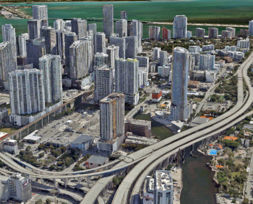 https://vexceldata.com/wp-content/uploads/2025/08/Miami_3D_City_1.jpg
720
1280
Angie Brewster
https://vexceldata.com/wp-content/uploads/2021/12/VEXCEL-Data-Program.png
Angie Brewster2025-08-20 08:07:282025-08-20 08:07:28See It. Plan It. Perfect It. How Vexcel Data Elevates AEC Projects
https://vexceldata.com/wp-content/uploads/2025/08/Miami_3D_City_1.jpg
720
1280
Angie Brewster
https://vexceldata.com/wp-content/uploads/2021/12/VEXCEL-Data-Program.png
Angie Brewster2025-08-20 08:07:282025-08-20 08:07:28See It. Plan It. Perfect It. How Vexcel Data Elevates AEC Projects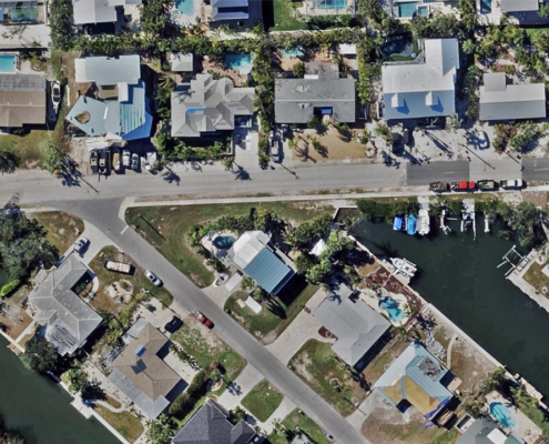 https://vexceldata.com/wp-content/uploads/2025/08/Holmes-Beach-FL-27.524300-82.726159.jpg
720
1280
Angie Brewster
https://vexceldata.com/wp-content/uploads/2021/12/VEXCEL-Data-Program.png
Angie Brewster2025-08-13 16:08:512025-08-13 16:08:51Unmasking Fraud in Property Claims: How NICB & Vexcel Illuminate the Truth
https://vexceldata.com/wp-content/uploads/2025/08/Holmes-Beach-FL-27.524300-82.726159.jpg
720
1280
Angie Brewster
https://vexceldata.com/wp-content/uploads/2021/12/VEXCEL-Data-Program.png
Angie Brewster2025-08-13 16:08:512025-08-13 16:08:51Unmasking Fraud in Property Claims: How NICB & Vexcel Illuminate the Truth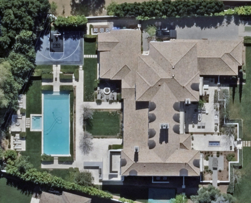 https://vexceldata.com/wp-content/uploads/2025/08/4615-N-Launfal-Ave-Phoenix-AZ-85018-USA.jpg
720
1280
Angie Brewster
https://vexceldata.com/wp-content/uploads/2021/12/VEXCEL-Data-Program.png
Angie Brewster2025-08-07 17:57:332025-08-12 09:59:392025 U.S. Collection Update
https://vexceldata.com/wp-content/uploads/2025/08/4615-N-Launfal-Ave-Phoenix-AZ-85018-USA.jpg
720
1280
Angie Brewster
https://vexceldata.com/wp-content/uploads/2021/12/VEXCEL-Data-Program.png
Angie Brewster2025-08-07 17:57:332025-08-12 09:59:392025 U.S. Collection Update https://vexceldata.com/wp-content/uploads/2025/07/Tokyo-Japan-35.693893-139.701289.jpg
720
1280
Angie Brewster
https://vexceldata.com/wp-content/uploads/2021/12/VEXCEL-Data-Program.png
Angie Brewster2025-07-30 19:46:292025-07-31 06:35:46We’re Big in Japan: Vexcel’s High-res Imagery Brings Cities to Life
https://vexceldata.com/wp-content/uploads/2025/07/Tokyo-Japan-35.693893-139.701289.jpg
720
1280
Angie Brewster
https://vexceldata.com/wp-content/uploads/2021/12/VEXCEL-Data-Program.png
Angie Brewster2025-07-30 19:46:292025-07-31 06:35:46We’re Big in Japan: Vexcel’s High-res Imagery Brings Cities to Life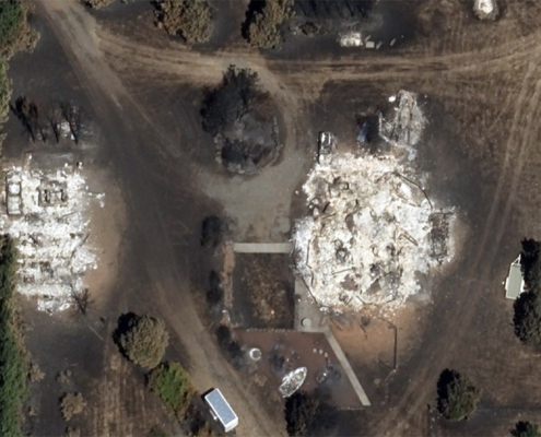 https://vexceldata.com/wp-content/uploads/2025/07/45.707060-121.303022-Lyle-WA-wildfire-after.jpg
573
1024
Angie Brewster
https://vexceldata.com/wp-content/uploads/2021/12/VEXCEL-Data-Program.png
Angie Brewster2025-07-24 18:31:312025-07-25 16:24:45Gray Sky: Burdoin, WA Fire
https://vexceldata.com/wp-content/uploads/2025/07/45.707060-121.303022-Lyle-WA-wildfire-after.jpg
573
1024
Angie Brewster
https://vexceldata.com/wp-content/uploads/2021/12/VEXCEL-Data-Program.png
Angie Brewster2025-07-24 18:31:312025-07-25 16:24:45Gray Sky: Burdoin, WA Fire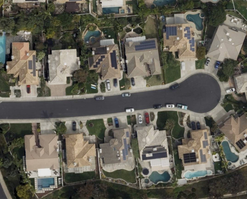 https://vexceldata.com/wp-content/uploads/2025/07/33.476080-117.62631-SanClementeCA.jpg
579
1024
Angie Brewster
https://vexceldata.com/wp-content/uploads/2021/12/VEXCEL-Data-Program.png
Angie Brewster2025-07-23 09:24:492025-07-23 09:24:49Top 3 Ways Vexcel API 2.0 Delivers Powerful AI Insights on Properties
https://vexceldata.com/wp-content/uploads/2025/07/33.476080-117.62631-SanClementeCA.jpg
579
1024
Angie Brewster
https://vexceldata.com/wp-content/uploads/2021/12/VEXCEL-Data-Program.png
Angie Brewster2025-07-23 09:24:492025-07-23 09:24:49Top 3 Ways Vexcel API 2.0 Delivers Powerful AI Insights on Properties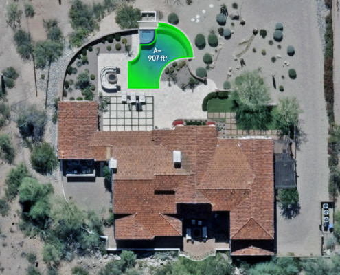 https://vexceldata.com/wp-content/uploads/2025/07/4743-N-54th-St-Phoenix-AZ-85018-USA_polygon.jpg
720
1280
Angie Brewster
https://vexceldata.com/wp-content/uploads/2021/12/VEXCEL-Data-Program.png
Angie Brewster2025-07-16 08:00:442025-07-16 08:01:18How Many Pools are in Phoenix? Elements AI Gave Us the Answer
https://vexceldata.com/wp-content/uploads/2025/07/4743-N-54th-St-Phoenix-AZ-85018-USA_polygon.jpg
720
1280
Angie Brewster
https://vexceldata.com/wp-content/uploads/2021/12/VEXCEL-Data-Program.png
Angie Brewster2025-07-16 08:00:442025-07-16 08:01:18How Many Pools are in Phoenix? Elements AI Gave Us the Answer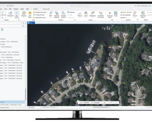 https://vexceldata.com/wp-content/uploads/2025/07/ArcGIS-Computer-Screen.png
777
1280
Angie Brewster
https://vexceldata.com/wp-content/uploads/2021/12/VEXCEL-Data-Program.png
Angie Brewster2025-07-09 08:06:462025-07-09 08:06:46Need Fast Access to Imagery and Data in ArcGIS? Vexcel Has You Covered
https://vexceldata.com/wp-content/uploads/2025/07/ArcGIS-Computer-Screen.png
777
1280
Angie Brewster
https://vexceldata.com/wp-content/uploads/2021/12/VEXCEL-Data-Program.png
Angie Brewster2025-07-09 08:06:462025-07-09 08:06:46Need Fast Access to Imagery and Data in ArcGIS? Vexcel Has You Covered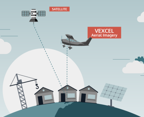 https://vexceldata.com/wp-content/uploads/2025/07/VEX-623-GRA-Satellite-vs-Aerial-Graphic_Light-BG_Satellite-Aerial.png
576
1024
Angie Brewster
https://vexceldata.com/wp-content/uploads/2021/12/VEXCEL-Data-Program.png
Angie Brewster2025-07-03 08:38:432025-07-09 15:30:51Aerial vs. Satellite Imagery: What’s the Difference, and Why It Matters
https://vexceldata.com/wp-content/uploads/2025/07/VEX-623-GRA-Satellite-vs-Aerial-Graphic_Light-BG_Satellite-Aerial.png
576
1024
Angie Brewster
https://vexceldata.com/wp-content/uploads/2021/12/VEXCEL-Data-Program.png
Angie Brewster2025-07-03 08:38:432025-07-09 15:30:51Aerial vs. Satellite Imagery: What’s the Difference, and Why It Matters