
Tag Archive for: geospatial analysis
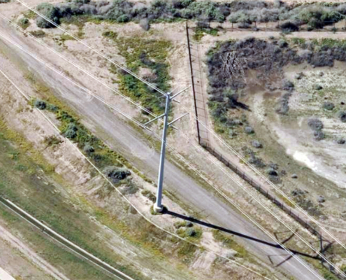 https://vexceldata.com/wp-content/uploads/2024/07/33.383524-112.229215-power-pole.jpg
576
1024
vexcel
https://vexceldata.com/wp-content/uploads/2021/12/VEXCEL-Data-Program.png
vexcel2024-07-30 07:16:182024-08-01 07:15:33How High-Res Aerial Imagery Revolutionizes Asset Management in the Utility Sector
https://vexceldata.com/wp-content/uploads/2024/07/33.383524-112.229215-power-pole.jpg
576
1024
vexcel
https://vexceldata.com/wp-content/uploads/2021/12/VEXCEL-Data-Program.png
vexcel2024-07-30 07:16:182024-08-01 07:15:33How High-Res Aerial Imagery Revolutionizes Asset Management in the Utility Sector https://vexceldata.com/wp-content/uploads/2023/12/EOY-Graphics_Cover.png
630
867
vexcel
https://vexceldata.com/wp-content/uploads/2021/12/VEXCEL-Data-Program.png
vexcel2023-12-28 10:03:242023-12-28 10:31:472023: The Year We Went BIGGER
https://vexceldata.com/wp-content/uploads/2023/12/EOY-Graphics_Cover.png
630
867
vexcel
https://vexceldata.com/wp-content/uploads/2021/12/VEXCEL-Data-Program.png
vexcel2023-12-28 10:03:242023-12-28 10:31:472023: The Year We Went BIGGER https://vexceldata.com/wp-content/uploads/2023/11/MSFS_WU15_Screenshots_01-scaled-1.jpg
1440
2560
vexcel
https://vexceldata.com/wp-content/uploads/2021/12/VEXCEL-Data-Program.png
vexcel2023-11-14 11:53:242023-11-14 11:53:24Vexcel imagery used in latest Microsoft Flight Simulator release
https://vexceldata.com/wp-content/uploads/2023/11/MSFS_WU15_Screenshots_01-scaled-1.jpg
1440
2560
vexcel
https://vexceldata.com/wp-content/uploads/2021/12/VEXCEL-Data-Program.png
vexcel2023-11-14 11:53:242023-11-14 11:53:24Vexcel imagery used in latest Microsoft Flight Simulator release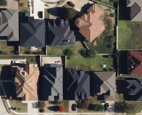 https://vexceldata.com/wp-content/uploads/2023/10/Irving-texas-us-ortho-residential-32.844341_-97.013052-copy.jpg
576
1024
vexcel
https://vexceldata.com/wp-content/uploads/2021/12/VEXCEL-Data-Program.png
vexcel2023-11-10 15:21:212024-06-14 09:51:19Vexcel Partnering with LexisNexis for Rooftop Solution
https://vexceldata.com/wp-content/uploads/2023/10/Irving-texas-us-ortho-residential-32.844341_-97.013052-copy.jpg
576
1024
vexcel
https://vexceldata.com/wp-content/uploads/2021/12/VEXCEL-Data-Program.png
vexcel2023-11-10 15:21:212024-06-14 09:51:19Vexcel Partnering with LexisNexis for Rooftop Solution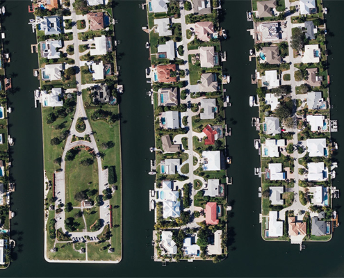 https://vexceldata.com/wp-content/uploads/2022/01/12-Starfish-Dr-Vero-Beach-FL-32960-USA.jpg
576
1024
vexcel
https://vexceldata.com/wp-content/uploads/2021/12/VEXCEL-Data-Program.png
vexcel2023-02-13 18:58:202023-03-03 21:44:39BIG News: Vexcel Enhancing & Refreshing U.S. Collection Program in 2023
https://vexceldata.com/wp-content/uploads/2022/01/12-Starfish-Dr-Vero-Beach-FL-32960-USA.jpg
576
1024
vexcel
https://vexceldata.com/wp-content/uploads/2021/12/VEXCEL-Data-Program.png
vexcel2023-02-13 18:58:202023-03-03 21:44:39BIG News: Vexcel Enhancing & Refreshing U.S. Collection Program in 2023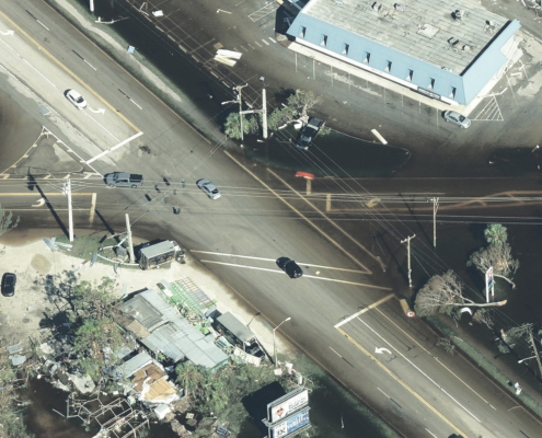 https://vexceldata.com/wp-content/uploads/2022/10/26.499674-81.967837.jpeg
987
1755
vexcel
https://vexceldata.com/wp-content/uploads/2021/12/VEXCEL-Data-Program.png
vexcel2022-10-09 16:28:572025-12-30 16:01:45Assess Utilities & Infrastructure After Disaster with High-res Aerial Imagery
https://vexceldata.com/wp-content/uploads/2022/10/26.499674-81.967837.jpeg
987
1755
vexcel
https://vexceldata.com/wp-content/uploads/2021/12/VEXCEL-Data-Program.png
vexcel2022-10-09 16:28:572025-12-30 16:01:45Assess Utilities & Infrastructure After Disaster with High-res Aerial Imagery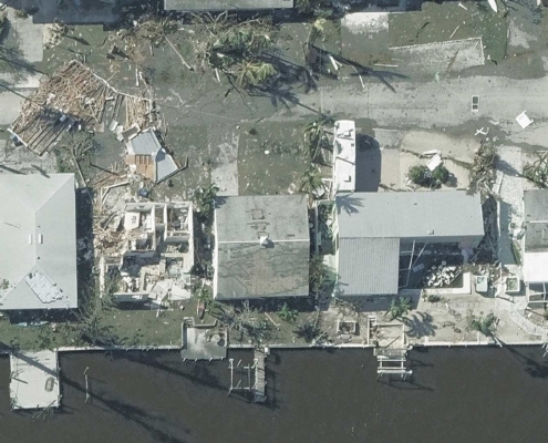 https://vexceldata.com/wp-content/uploads/2022/10/GIC-Aerial-Imagery-5.jpg
1080
1920
vexcel
https://vexceldata.com/wp-content/uploads/2021/12/VEXCEL-Data-Program.png
vexcel2022-10-05 17:03:042022-10-27 17:43:59Capturing Hurricane Ian’s Destructive Path
https://vexceldata.com/wp-content/uploads/2022/10/GIC-Aerial-Imagery-5.jpg
1080
1920
vexcel
https://vexceldata.com/wp-content/uploads/2021/12/VEXCEL-Data-Program.png
vexcel2022-10-05 17:03:042022-10-27 17:43:59Capturing Hurricane Ian’s Destructive Path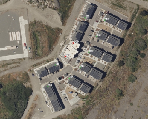 https://vexceldata.com/wp-content/uploads/2022/08/PoPNetworkFairhaven.jpg
1983
2475
vexcel
https://vexceldata.com/wp-content/uploads/2021/12/VEXCEL-Data-Program.png
vexcel2022-08-23 16:05:102022-10-26 11:50:48How Dalet Access Labs is Using Vexcel Data for High-speed Network Planning
https://vexceldata.com/wp-content/uploads/2022/08/PoPNetworkFairhaven.jpg
1983
2475
vexcel
https://vexceldata.com/wp-content/uploads/2021/12/VEXCEL-Data-Program.png
vexcel2022-08-23 16:05:102022-10-26 11:50:48How Dalet Access Labs is Using Vexcel Data for High-speed Network Planning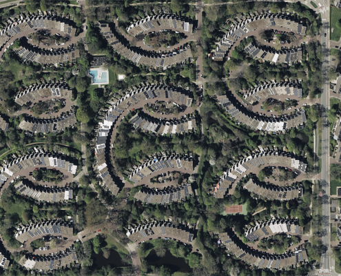 https://vexceldata.com/wp-content/uploads/2022/06/bluesky-ortho-Netherlands-01.jpg
720
1280
vexcel
https://vexceldata.com/wp-content/uploads/2021/12/VEXCEL-Data-Program.png
vexcel2022-07-28 15:46:532024-06-14 09:55:09Earth-i Names Vexcel as First Remote Sensing Partner
https://vexceldata.com/wp-content/uploads/2022/06/bluesky-ortho-Netherlands-01.jpg
720
1280
vexcel
https://vexceldata.com/wp-content/uploads/2021/12/VEXCEL-Data-Program.png
vexcel2022-07-28 15:46:532024-06-14 09:55:09Earth-i Names Vexcel as First Remote Sensing Partner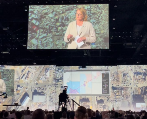 https://vexceldata.com/wp-content/uploads/2022/07/Screen-Shot-2022-07-19-at-11.40.19-AM.png
564
1117
vexcel
https://vexceldata.com/wp-content/uploads/2021/12/VEXCEL-Data-Program.png
vexcel2022-07-19 18:38:562025-12-30 16:29:53Esri UC 2022 – Full of Excitement and Announcement
https://vexceldata.com/wp-content/uploads/2022/07/Screen-Shot-2022-07-19-at-11.40.19-AM.png
564
1117
vexcel
https://vexceldata.com/wp-content/uploads/2021/12/VEXCEL-Data-Program.png
vexcel2022-07-19 18:38:562025-12-30 16:29:53Esri UC 2022 – Full of Excitement and Announcement