
Tag Archive for: aerial imagery
 https://vexceldata.com/wp-content/uploads/2025/10/Federal-Heights-CO-39.856811-105.011138_oblique.jpg
720
1280
vexcel
https://vexceldata.com/wp-content/uploads/2021/12/VEXCEL-Data-Program.png
vexcel2025-10-23 09:25:422026-04-14 15:45:44Safer Communities Through Smarter Data
https://vexceldata.com/wp-content/uploads/2025/10/Federal-Heights-CO-39.856811-105.011138_oblique.jpg
720
1280
vexcel
https://vexceldata.com/wp-content/uploads/2021/12/VEXCEL-Data-Program.png
vexcel2025-10-23 09:25:422026-04-14 15:45:44Safer Communities Through Smarter Data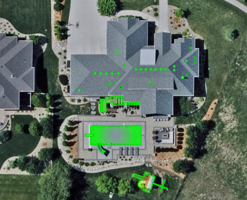 https://vexceldata.com/wp-content/uploads/2025/10/Sioux-Falls-SD-43.481424-96.719737-1.jpg
720
1280
vexcel
https://vexceldata.com/wp-content/uploads/2021/12/VEXCEL-Data-Program.png
vexcel2025-10-15 10:50:122026-04-14 16:13:48Underwriting, Upgraded: 5 Ways Vexcel Shortens the Path from Submission to Smart Decision
https://vexceldata.com/wp-content/uploads/2025/10/Sioux-Falls-SD-43.481424-96.719737-1.jpg
720
1280
vexcel
https://vexceldata.com/wp-content/uploads/2021/12/VEXCEL-Data-Program.png
vexcel2025-10-15 10:50:122026-04-14 16:13:48Underwriting, Upgraded: 5 Ways Vexcel Shortens the Path from Submission to Smart Decision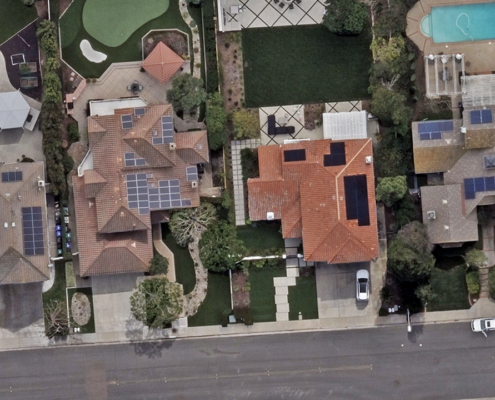 https://vexceldata.com/wp-content/uploads/2025/10/San-Diego-CA-32.900532-117.068414.jpg
720
1280
vexcel
https://vexceldata.com/wp-content/uploads/2021/12/VEXCEL-Data-Program.png
vexcel2025-10-08 10:08:462026-04-14 15:45:50Managing Risk with Clarity: Spot Distressed Assets Early
https://vexceldata.com/wp-content/uploads/2025/10/San-Diego-CA-32.900532-117.068414.jpg
720
1280
vexcel
https://vexceldata.com/wp-content/uploads/2021/12/VEXCEL-Data-Program.png
vexcel2025-10-08 10:08:462026-04-14 15:45:50Managing Risk with Clarity: Spot Distressed Assets Early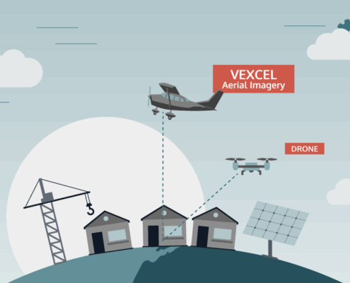 https://vexceldata.com/wp-content/uploads/2025/09/VEX-623-GRA-Satellite-vs-Aerial-Graphic_Light-BG_Aerial-Drone.png
576
1024
vexcel
https://vexceldata.com/wp-content/uploads/2021/12/VEXCEL-Data-Program.png
vexcel2025-09-30 09:01:522026-04-14 15:45:53Aerial vs. Drone: What the Power of Scale Can Do
https://vexceldata.com/wp-content/uploads/2025/09/VEX-623-GRA-Satellite-vs-Aerial-Graphic_Light-BG_Aerial-Drone.png
576
1024
vexcel
https://vexceldata.com/wp-content/uploads/2021/12/VEXCEL-Data-Program.png
vexcel2025-09-30 09:01:522026-04-14 15:45:53Aerial vs. Drone: What the Power of Scale Can Do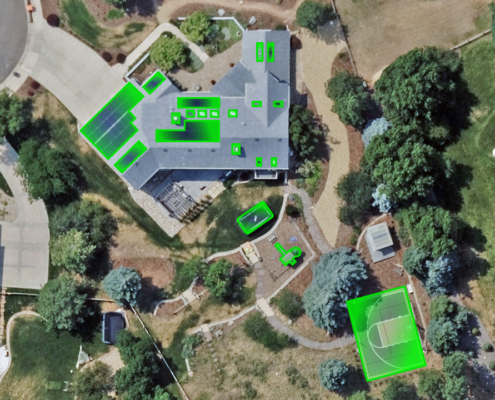 https://vexceldata.com/wp-content/uploads/2025/09/Littleton-CO-39.580492-105.169218.jpg
720
1280
vexcel
https://vexceldata.com/wp-content/uploads/2021/12/VEXCEL-Data-Program.png
vexcel2025-09-23 11:25:562026-04-14 15:45:54Keeping Up with Change: How Vexcel Helps Tax Assessors Modernize Property Assessment
https://vexceldata.com/wp-content/uploads/2025/09/Littleton-CO-39.580492-105.169218.jpg
720
1280
vexcel
https://vexceldata.com/wp-content/uploads/2021/12/VEXCEL-Data-Program.png
vexcel2025-09-23 11:25:562026-04-14 15:45:54Keeping Up with Change: How Vexcel Helps Tax Assessors Modernize Property Assessment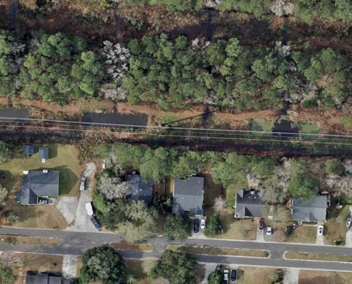 https://vexceldata.com/wp-content/uploads/2025/09/Charleston-SC-32.756116-79.986702.jpg
720
1280
vexcel
https://vexceldata.com/wp-content/uploads/2021/12/VEXCEL-Data-Program.png
vexcel2025-09-11 08:30:452026-04-14 15:45:55Mapping the Path Forward
https://vexceldata.com/wp-content/uploads/2025/09/Charleston-SC-32.756116-79.986702.jpg
720
1280
vexcel
https://vexceldata.com/wp-content/uploads/2021/12/VEXCEL-Data-Program.png
vexcel2025-09-11 08:30:452026-04-14 15:45:55Mapping the Path Forward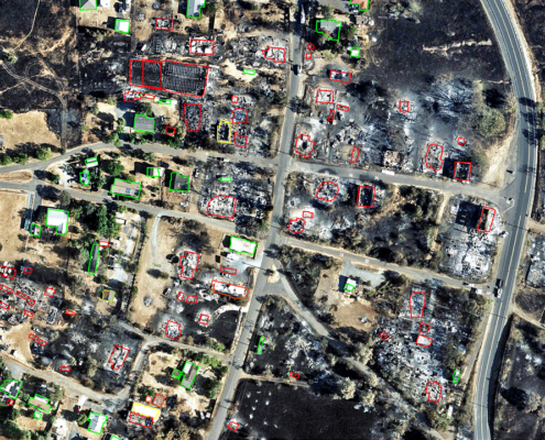 https://vexceldata.com/wp-content/uploads/2025/09/Chinese-Camp-CA-37.870798-120.433192.jpg
720
1280
vexcel
https://vexceldata.com/wp-content/uploads/2021/12/VEXCEL-Data-Program.png
vexcel2025-09-08 22:53:522026-04-14 15:30:04Gray Sky: TCU Lightning Complex Fires
https://vexceldata.com/wp-content/uploads/2025/09/Chinese-Camp-CA-37.870798-120.433192.jpg
720
1280
vexcel
https://vexceldata.com/wp-content/uploads/2021/12/VEXCEL-Data-Program.png
vexcel2025-09-08 22:53:522026-04-14 15:30:04Gray Sky: TCU Lightning Complex Fires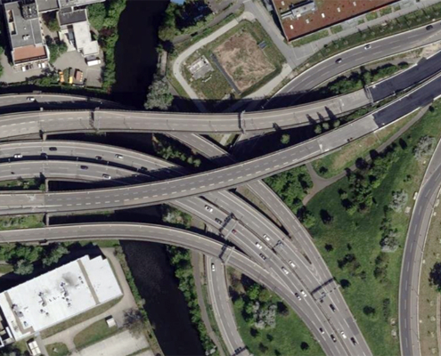 https://vexceldata.com/wp-content/uploads/2025/09/Berlin-Germany-52.463780-13.453301.jpg
576
1024
vexcel
https://vexceldata.com/wp-content/uploads/2021/12/VEXCEL-Data-Program.png
vexcel2025-09-05 14:09:032026-04-14 15:45:56Seeing the Road Ahead: How Vexcel Supports Smarter Transportation Planning
https://vexceldata.com/wp-content/uploads/2025/09/Berlin-Germany-52.463780-13.453301.jpg
576
1024
vexcel
https://vexceldata.com/wp-content/uploads/2021/12/VEXCEL-Data-Program.png
vexcel2025-09-05 14:09:032026-04-14 15:45:56Seeing the Road Ahead: How Vexcel Supports Smarter Transportation Planning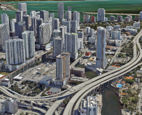 https://vexceldata.com/wp-content/uploads/2025/08/Miami_3D_City_1.jpg
720
1280
vexcel
https://vexceldata.com/wp-content/uploads/2021/12/VEXCEL-Data-Program.png
vexcel2025-08-20 08:07:282026-04-14 15:45:58See It. Plan It. Perfect It. How Vexcel Data Elevates AEC Projects
https://vexceldata.com/wp-content/uploads/2025/08/Miami_3D_City_1.jpg
720
1280
vexcel
https://vexceldata.com/wp-content/uploads/2021/12/VEXCEL-Data-Program.png
vexcel2025-08-20 08:07:282026-04-14 15:45:58See It. Plan It. Perfect It. How Vexcel Data Elevates AEC Projects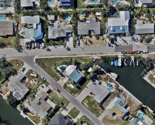 https://vexceldata.com/wp-content/uploads/2025/08/Holmes-Beach-FL-27.524300-82.726159.jpg
720
1280
vexcel
https://vexceldata.com/wp-content/uploads/2021/12/VEXCEL-Data-Program.png
vexcel2025-08-13 16:08:512026-04-14 15:52:22Unmasking Fraud in Property Claims: How NICB & Vexcel Illuminate the Truth
https://vexceldata.com/wp-content/uploads/2025/08/Holmes-Beach-FL-27.524300-82.726159.jpg
720
1280
vexcel
https://vexceldata.com/wp-content/uploads/2021/12/VEXCEL-Data-Program.png
vexcel2025-08-13 16:08:512026-04-14 15:52:22Unmasking Fraud in Property Claims: How NICB & Vexcel Illuminate the Truth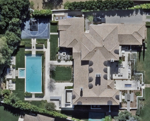 https://vexceldata.com/wp-content/uploads/2025/08/4615-N-Launfal-Ave-Phoenix-AZ-85018-USA.jpg
720
1280
vexcel
https://vexceldata.com/wp-content/uploads/2021/12/VEXCEL-Data-Program.png
vexcel2025-08-07 17:57:332026-04-14 15:45:592025 U.S. Collection Update
https://vexceldata.com/wp-content/uploads/2025/08/4615-N-Launfal-Ave-Phoenix-AZ-85018-USA.jpg
720
1280
vexcel
https://vexceldata.com/wp-content/uploads/2021/12/VEXCEL-Data-Program.png
vexcel2025-08-07 17:57:332026-04-14 15:45:592025 U.S. Collection Update https://vexceldata.com/wp-content/uploads/2025/07/Tokyo-Japan-35.693893-139.701289.jpg
720
1280
vexcel
https://vexceldata.com/wp-content/uploads/2021/12/VEXCEL-Data-Program.png
vexcel2025-07-30 19:46:292026-04-14 15:46:00We’re Big in Japan: Vexcel’s High-res Imagery Brings Cities to Life
https://vexceldata.com/wp-content/uploads/2025/07/Tokyo-Japan-35.693893-139.701289.jpg
720
1280
vexcel
https://vexceldata.com/wp-content/uploads/2021/12/VEXCEL-Data-Program.png
vexcel2025-07-30 19:46:292026-04-14 15:46:00We’re Big in Japan: Vexcel’s High-res Imagery Brings Cities to Life